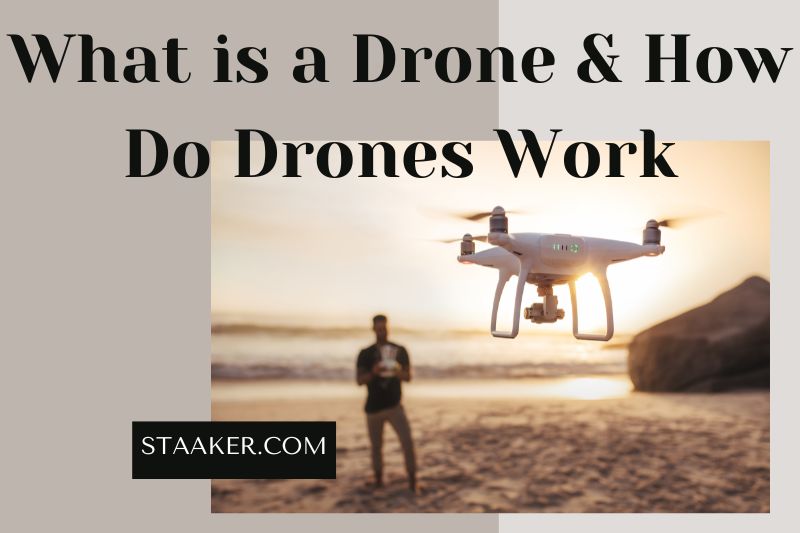
Drones are becoming increasingly popular for both personal and commercial use. But how do drones work?
Drones are usually remotely controlled by a pilot on the ground, but they can also be programmed to fly autonomously. Depending on their purpose, drones can be equipped with various cameras, sensors, and other technology.
What Is A Drone Technology?
Unmanned aircraft is a drone. Uncrewed aerial vehicles (UAVs) or unmanned aircraft systems are more commonly known as drones. A drone is a flying robot that can remotely be controlled or flown autonomously using a software-controlled flight plan in its embedded systems.
These integrated systems work with onboard sensors and a global positioning satellite (GPS).
UAVs were often associated with military personnel. UAVs were first used to practice anti-aircraft targeting, gather intelligence, and, more controversially, as weapons platforms. These drones can also be used for civilian purposes, such as the following:
- Search and rescue
- surveillance
- Traffic monitoring
- Weather monitoring
- firefighting
- Personal use
- Drone-based photography
- Videography
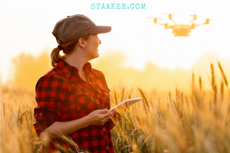
- Agriculture
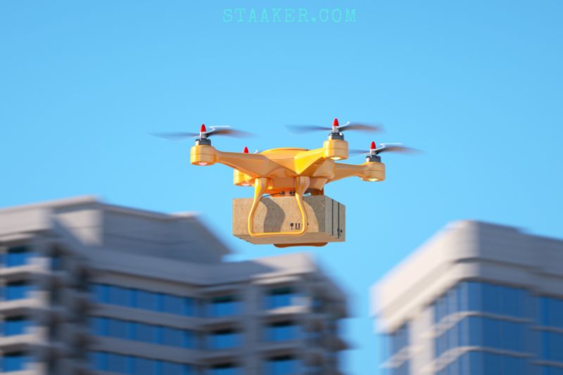
- Delivery services
How Do Drones Work?
Drones can perform two functions: navigation and flight mode.
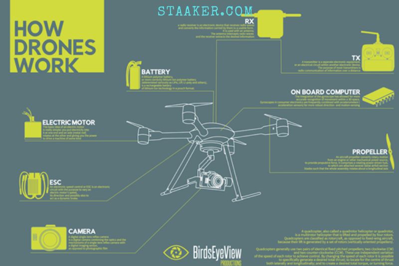
Drones cannot fly without a power source such as fuel or battery. A drone also has propellers, rotors, and a frame. To reduce weight and improve maneuverability, the frame of a drone is usually made from lightweight composite materials.
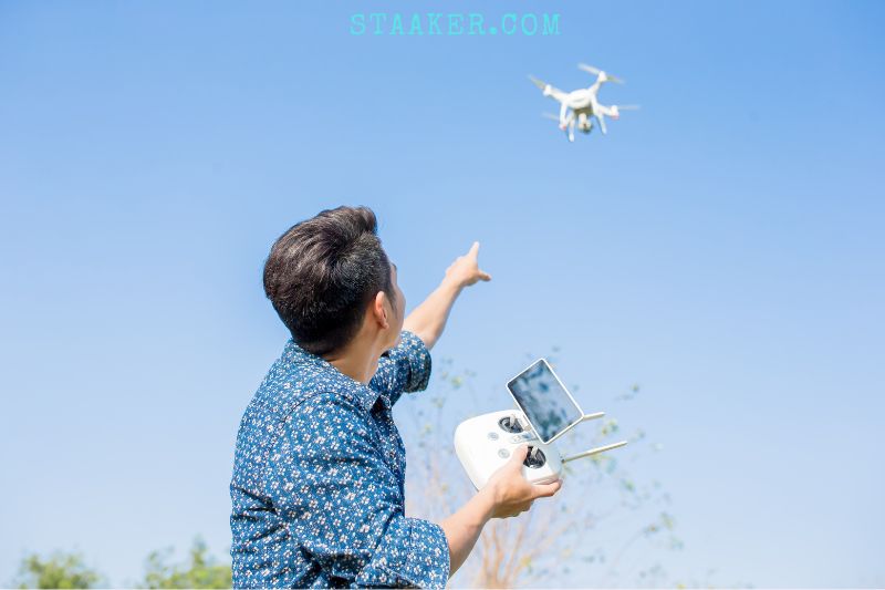
A controller is required for drones. This allows the operator to use remote controls to launch, navigate, and land the aircraft. The drone communicates with its controllers using radio waves such as Wi-Fi.
Accelerometer, Altimeter
An altimeter and an accelerometer provide information to the drone about its speed and direction. These features help drones land safely and slowly, so it doesn’t sink into an air vacuum that could cause an unpredicted descent.
GPS
The GPS in your car or phone that guides you around is something we are all familiar with. But drones also have this feature. Drones can use GPS to collect location-based data such as aerial imagery and surveying. How does it all work?
GPS must be connected to a GPS chip or module in the drone. Currently, 32 GPS satellites orbiting the earth are part of the GLONASS (Global Navigation Satellite System). GLONASS, a Russian-based satellite system, is used for positioning purposes by civilians and military personnel.
Only 24 of these satellites will be available at any one time. A drone does not have to be connected to all 24 satellites. The drones must connect to at most 8 satellites, but the more the module can connect, the better. These satellites are used to communicate with the module and calculate its position.
The drone apps display bars that indicate the strength of the GPS connection. There are LED lights that can alert you if there is a problem with GPS, as well as the bars showing how strong your connection is.
Your drone may be unable to access enough satellites if it doesn’t have the right equipment. Cloud cover, tall buildings, mountains, and trees could all be why your drone is not connecting to the satellites.
You now know the basics of GPS and how it works. Here are some ways GPS can help the drone function.
Altitude Hold
As we mentioned, barometric and GPS sensors can be used to maintain the drone’s altitude. Some drones have an altitude limit. The FAA requires that drones stay at an altitude below 400 feet. GPS can be used to limit drones to a specific altitude.
Hover
This is also known as position hold. It’s where the drone takes off and stays in the same place and at the same altitude until you give it instructions. It makes flying a drone easy for even beginners.
The drone won’t move if you aren’t sure how to control it. It may drift slightly, especially in windy conditions, but it will always correct this.
Return Home
This feature is essential, especially when there are low battery levels or emergencies. The drone can return to its take-off point by using the coordinates.
It is essential to calibrate your GPS accurately and allow it to lock the take-off point. Once you have done this, the RTH feature will be activated, and the drone will remain in its original location.
Some drones can initiate RTH automatically if they lose connection, experience interference, or have low battery levels.
How Autonomous Drones Work (Waypoints)
GPS allows drones to fly thanks to GPS autonomously. How? You need to assign waypoints. These are the coordinates that the drone will be able to fly through. You can use it to film, map, or survey while the drone takes off on its own.
Radar Detection: How Do Drones Communicate To Controllers?
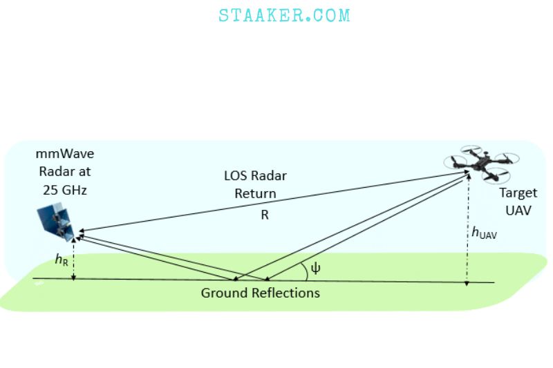
Radar can detect drones, just like ships and airplanes. This is how radar works. Radar systems detect radio signals from bodies. Drones communicate with controllers via radio signals, as we mentioned previously.
You can design a system to identify signals in the drone communication ranges and other behaviors that drones exhibit. These systems are already in existence. Examples include DJI’s Aeroscope and AirSpace Galaxy.
Failsafe And Internal compass
Internal compasses are also available for drones. These work with GPS to increase stability and ensure that the drone is correctly oriented. The GPS module usually comes with a compass.
Calibrating the compass is a crucial step in setting up a drone. The drones won’t take off unless the calibration of the compass is done correctly.
You must calibrate your compass in an open area free from magnetic interference. When you move to another location, calibration is essential.
Don’t forget that incorrectly calibrated compasses can cause problems with GPS functions, such as finding satellites.
As I mentioned, drone compasses have magnetometers that detect anomalies and assist flight controllers in considering all factors. This is done to ensure the drone is correctly oriented and prevent fly-aways from being caused by poor GPS or electromagnetic interference.
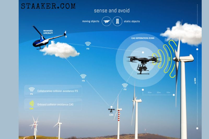
High-tech Drone Technology: Collision Avoidance And Obstacle Detection
When I was talking about sensors, it came up that drones can use many technologies to detect obstacles. These technologies include LiDAR and monocular vision, ultrasonic, time-of-flight, ultrasonic, stereovision, infrared, and time-of-flight.
That’s a lot of sensors. So how can drones make use of all these sensors to avoid obstacles? A combination of algorithms, modeling, machine learning, AI, and machine learning. Algorithms can learn how objects look and “learn” how to associate each object with their information to determine if it is an obstacle.
SLAM (Simultaneous Localization & Mapping) is another fascinating technology that allows obstacle avoidance. This feature allows drones to map their current environment using data from sensors and a pre-installed environment.
Collision Avoidance
What I have just said does not help a drone find an object ahead of time. It will have to find an alternate route and calculate the object’s exact location to avoid it. Stereopsis, or stereovision, is one-way drones can achieve this.
The most advanced drones will feature two cameras on the front. After obtaining the object’s image from two perspectives, they can triangulate the 3D perspective to calculate it. This allows them to see their environment in 3D and perceive distance and depth.
Intelligent Flight Modes
Drones actively collect data that can be used to map a route that the drone will take without any input from the pilot. You can pre-program different flight patterns with an operating system (more details later). These are known as intelligent flight modes.
This technology allows drones to detect objects and also allows them to identify objects. ActiveTrack is also available in DJI drones. You can set yourself up as the POI, and then the drone will follow you, filming you while avoiding obstacles.
There are also intelligent flight modes like
- Altitude Hold
- Auto-Return Home
- Position Mode (Position Mode)
- Attitude Mode (ATTI Mode)
- TapFly –
- Quickshots – Dronies, Helix, Circle, Rocket, etc.
- Waypoints
- Cinematic Mode
Parameters In Real-Time
Drones can now communicate real-time telemetry information with the controller or great drone app. This information includes the battery level, GPS connection, altitude and other aspects.
Alerts can be sent when the drone is outside its operating range, flying too fast or in restricted areas. This information allows you to monitor your drone better and reduce the chance of colliding with something.
Geofencing
Geofencing, an alert system that notifies drones entering restricted airspace (also known as No-Fly Zones), enforces restrictions. These areas include military bases, the White House and airports. If you don’t find a way around this restriction, your drone won’t take off from these areas.
Geofencing does not apply to all drones. It requires a drone to have GPS and must be connected to the map with No-Fly Zones.
Drone Operating Systems (Firmware).
Drones can be described as flying computers. We’ve seen that drones are like flying computers. Sensors collect data, communicate with the controller, control propellers and batteries and perform many other functions.
What powers the whole thing? Drones use firmware often developed on Linux, but some also use MS Windows. Manufacturers can also use open-source operating systems for drones instead of creating one from scratch. These include:
- Linux’s Dronecode
- FlytOS
- Auterion
Regular updates to drone firmware are necessary to ensure that all components work as intended or introduce new features.
Software And Firmware
Software for drones has increased in popularity to allow them to be used in different industries. Here are the top industries in which drones are used and the software they can use.
- Filming and Photography – Lightworks, iMovie and VSDC Free video editor, HitFilm Express and Davinci Resolve.
- Surveying, Mapping and Aerial Photography – DroneDeploy.
- Construction – 3DR and PixPro, as well as Datumate
- Agriculture – SLANTRANGE, AgEagle.
Regular updates to drone firmware are necessary to ensure that all components work as intended or introduce new features.
The drone’s antenna, or receiver, will be at the other end. This will receive the signal from the drone and convert it into a video you can view on your smartphone’s screen. You can also buy FPV goggles to make it feel like you are in the drone’s cockpit. Drone racing is a rapidly-growing sport that includes FPV.
Although drone racing is relatively new, there are many leagues like the Multi GP or DRL where drone pilots can compete for thousands of dollars and receive sponsorship deals, just like professional athletes.
These races can also be streamed live on TV so other drone pilots and hobbyists can see and feel the adrenaline.
Other Drone Sensors
Drones have the unique ability to carry a payload. To extend the drone’s usefulness and utility, you can add sensors.
Apart from the sensors that aid the drone in navigation, multispectral sensors can be attached to agricultural applications and Lidar sensors for construction inspection.
Cameras are sensors that operate in visible light. These sensors are hardware and can be analyzed using the software I have mentioned to gain meaningful information crucial for decision-making.
Hacking And Security
Drones are computers and can be hacked. They can also spy on others or hack into other systems. It’s not difficult to hack into drones.
Hackers can hack into your drone, download footage you’ve taken or use it to hack into your home network. Hackers can also take control of your drone using a technique called GPS Spoofing. This allows them to guide the drone to “false coordinates”. Here are some ways to prevent your drone from being hacked.
- Firmware updates – Drone manufacturers regularly update the firmware. You can ensure your drone is safe by using the latest firmware.
- To prevent outsiders from accessing your network, use a VPN.
- Anti-Virus protects your laptop and smartphone. You expose your drone to malware by transferring footage from the drone to the smartphone or controlling the drone with the smartphone.
- As much as possible, set the Return to home point manually
- Secure your home network and app with a strong password
- Limit the number of people who can use the home network at once.
How Does A Drone Camera Work
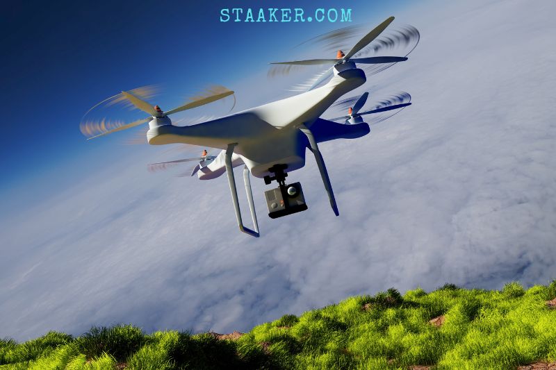
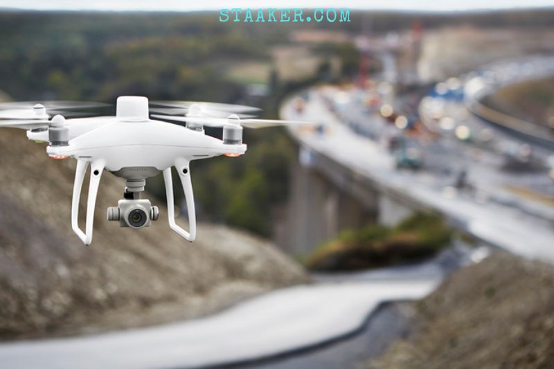
Some drones have built-in cameras that enable the pilot to see the drone’s location without being in direct view. Drone-mounted cameras can help first responders see hard-to-reach areas and can even be used in rescue situations.
Because drones are so complexly designed, pilots, don’t have to worry about balance and thrust. They can simply enjoy flying them. Experts can race drones through high-speed obstacle courses thanks to their ultra-responsive nature.
Drones can be versatile equipment that uses wireless technology to perform everything, from video capture to emergency response. Their utility will only increase as technology improves and the world gets more connected.
Drone LED lights
All drones have LED lights. These LED lights can be used as ornaments, but they serve a purpose. They are most often used to notify you about the status of your drone. This post has covered many aspects of drone LED lights. Here are some key points and their meanings.
Low battery levels, IMU and other system errors, RTH, agility mode or low battery levels could all be red.
Standard colors include green, which indicates whether the GPS has enough satellites or if the battery level is suitable for taking off.
- White – LEDs with white color may indicate a weak or absent GPS connection or that the transmitter has been turned off.
- Blue – Blue can refer to Blind Mode or Stability Mode.
- Orange/Yellow: These colors could indicate a poor GPS connection or poor compass calibration.
- Purple – This is the color used to indicate that Follow-Me or Return to Home modes are functioning. If it blinks, this could indicate an issue with these modes. This is used in certain drones to indicate AP Mode.
Here is another type of LED light.
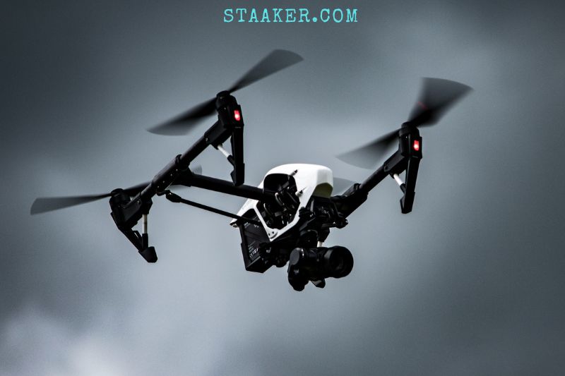
Anti-Collision lights – Also known as navigation lights, these lights make it easy for the operator to see your drone from far away. They also help prevent the drone from colliding with other drones and other objects. These lights are required by the FAA, as well as the Remote ID regulations. Depending on the drone model, they can be flashing or not flashing.
Please note that different colors can mean different things depending upon the drone you are using. It is important to check your manual for specific guidelines.
What Kinds Of Drones Are There?
There are two types of drone platforms.
- rotors (either single-rotor or multi-rotor), such as quadcopters, quadcopters and octocopters; and
- Fixed-wing includes the hybrid vertical take-off/ landing (VTOL), drones that aren’t required runways.
- Drones that are not military in nature are usually personal or hobbyist drones or commercial aircraft.
Personal Drones
There are many personal drones available for consumers. These drones are now a standard Black Friday and Cyber Tuesday deal, with HD video and still camera capabilities. Many operators are beginners looking to fly drones for racing or fun. Drones are usually 10 pounds or less in weight, but they can weigh as little as a pound.
These personal drones are very popular:
- Autel EVO II is a high-end video.
- DJI FPV Combo was designed for racing.
- DJI Air 2S is an excellent device for beginners, thanks to its foldable design and advanced sensor technology.
- DJI Mavic 3 drone camera is powerful and can sense obstacles in all directions.
- DJI Mini 2 weighs in at 242g.
- Parrot Anafi compact is wind-resistant, thanks to its advanced stabilization features.
- PowerVision PowerEgg X flies all-weather, lands on the water, and has AI capabilities. It can also be converted into a handheld camera.
- Ryze Tello is highly rated for beginners.
Commercial Drones
Commercial settings also have stronger, more capable drones. The ScanEagle is a UAV that has a 10-foot wingspan and 35-pound weight from Insitu, a Boeing Company. Insitu also produces the Integrator, a lightweight aircraft that weighs 80 pounds and has a 16-foot wingspan. Insitu drones don’t take off from runways.
They use VTOL capabilities in the company’s launchers, recovery systems and engines. There are several sensors available, including electro-optic images, mid-wave Infrared Imagers, laser rangefinders and infrared markers.
Boeing revealed in 2018 that it had developed an unmanned electric VTOL cargo aircraft capable of carrying up to a 500-pound payload.
Another option is to use tethered drones. They can be physically tied to a base station. If the tether supplies a direct power supply, tethered systems can solve many drone’s power supply problems.
Elistair’s SafeT drone tethering station can provide 2.5 kW power and can fly up to more than 200 feet. It also offers data transfer rates up to 200 Mbps.
Other than Insitu, Elistair and other drone manufacturers are:
- 3D Robotics
- DJI
- Hubsan
- Identified Technologies
- Measure
- Parrot
- PrecisionHawk
- Yuneec
Commercial Drones And Enterprise Drone Applications
The use of drones for non-military purposes has increased in the last decade. UAVs are not only used for delivery and surveillance but also for search and rescue, disaster response and asset protection.
Many enterprise applications have been created by the integration of drones with the internet of things (IoT). Drones that work with IoT sensor networks on the ground can be used to help companies such as agricultural companies monitor their land and crops, energy companies inspect power lines and other equipment, and insurance companies monitor the property for claims and policies.
One way to combine drones with IoT was demonstrated in Austin, Texas, in 2015. To provide a comprehensive overview of IoT networks in the city, a security company joined forces with a drone startup. Both companies reported that the results were fast and informative.
Unmanned aerial vehicles (IoT) and logistics are often discussed together. They are an integral part of ubiquitous connectivity and interactivity.
These are just a few examples of the best drone technology being used:
- Agriculture. Drones can measure and record the heights of crops. The drones use lidar remote sensing technology, which illuminates the crop using a laser. It then calculates distances by measuring what is reflected back. This technology can be used to optimize agricultural production and encourage sustainable farming practices.
- Biological monitoring. Drones equipped with biological sensors can fly into dangerous areas to collect water and air quality readings. They can also check for specific micro-organisms or atmospheric elements.
- Wildfire monitoring. Drones are used by firefighters to inspect affected areas and determine how quickly a fire spreads. The damage is shown in the images.
- Sports coverage. Television networks use drones for sporting event coverage. Drones must be compliant with the regulations of the S. Federal Aviation Administration (FAA), as well as those of the local sports league, venue, and law enforcement agency.
The History And Evolution Of Drones
Drones date back to 1849 Italy when Venice was fighting Austria for independence. Austrian soldiers attacked Venice using hot-air, hydrogen or helium-filled balloons armed with bombs.
In World War I, the first radio-controlled pilotless aircraft was built. The US Army created the Kettering Bug, an unmanned, “flying bomb” plane, in 1918. It was never used in combat.
In 1935, the first drone was widely used. It was a full-size retooling from the de Havilland DH82B Queen Bee biplane. It was fitted with a radio and servomechanism-operated controls in the back seat.
Although the plane could be piloted conventionally from the front seat of the aircraft, it was not equipped with any controls. It was used primarily for training artillery gunners to shoot.
This is the origin of the drone, an adaptation of “Queen Bee’ nomenclature.
UAV technology was still of interest to the military. However, it was not always reliable and expensive. The military revisited unmanned aerial vehicles after concerns were raised about the shooting down spy planes. Soon, military drones were used to drop leaflets and act as spy decoys.
The Israeli Air Force used UAVs in 1982 to eliminate the Syrian fleet. There was minimal loss of Israeli forces. UAVs from Israel were used as decoys to jam communication and offer real-time video surveillance.
As part of the military, IoT drones continue to be a majority in the military, performing the following roles:
- intelligence
- aerial surveillance
- Force protection
- Search and rescue
- Spotting artillery
- Target following and acquisition
- battle damage assessment
- reconnaissance
- Weaponry
These are some recent milestones in drone technology:
- 2006. UAVs were first used by the US Customs and Border Protection Agency to monitor the US and Mexican borders.
- Late 2012. Chris Anderson, Wired magazine’s editor-in-chief, has retired to devote himself to 3D Robotics Inc. It started out as a hobbyist drone manufacturer. It now sells UAVs for aerial photography or videography. It also sells to public safety, utilities, telecom, and construction companies.
- Ende 2013. Jeff Bezos, Amazon CEO, announced plans to use commercial drones for product deliveries.
- July 2016. Flirtey, a startup in Reno, Nev., beat Amazon to the punch. It delivered a package to Nevada residents using a commercial drone.
- September 2016. September 2016. Drone deliveries were tested by Virginia Polytechnic Institute, State University and Project Wing, an affiliate of Google Inc. They began with burritos at a Chipotle local restaurant.
- October 2016. Zipline, a San Francisco-based company, launched a service that delivers blood and drugs directly to Rwandan hospitals.
- March 2021. As part of the United Nations’ COVAX initiative, Zipline began delivering COVID-19 vaccinations to Ghanaian healthcare professionals.
- August 2021. Alphabet’s Project Wing announced it would surpass the 100,000 mark in drone delivery, which is yet another step towards proving that drone delivery is possible at scale.
UAV Reception And Drone Basic Principle
The rapid adoption of drones in the last decade has raised privacy, security, and safety concerns. Paparazzi and Voyeurs use drones to take photos of people at their homes or other places that were once considered private. Drones can also be used in dangerous locations such as near airports and urban areas.
The potential for drone control loss and collisions in midair has increased with both commercial and personal drone usage. Regulation is needed to address concerns regarding drones flying too close to commercial aircraft.
UAV regulations have been established in many countries. Laws are constantly changing as drone use grows in popularity. Both commercial and personal drone pilots need to check the laws in the country where they operate the drones.
China’s Civil Aviation Administration of China requires drone licenses for flying above 400 feet. A license is required for drones that weigh more than 15 pounds. No-fly zones are also necessary.
The Civil Aviation Authority (CAA) in the United Kingdom prohibits drones from flying higher than 500 feet. The CAA must register any drone that weighs more than half a pound. The agency also publishes its “Dronecode”:
- Avoid flying near airports and airfields.
- Keep your distance from people and buildings to at least 150 feet, and keep your height below 400 feet.
- At all times, be attentive to your drone
- Avoid flying near an aircraft.
- Enjoy responsibly.
Commercial drones were illegal until 2006. Operators had to follow Advisory Circular 91-5, Model Aircraft Operating Standards (published in 1981) before noncommercial flights were allowed below 400 feet. The chronology below shows how changes to US rules were made.
- 2005. The FAA published its first guidelines regarding UAVs.
- 2006. The FAA issued the first commercial drone permit.
- 2007. The FAA published a policy on drone operations.
- 2012. The FAA Modernization and Reform Act of 2012. was published. Section 333 gave the US Secretary for Transportation the authority to approve commercial drone use on a case-by-case basis.
- 2014. Only two US companies were permitted to use commercial drones.
- 2015. An FAA interim policy was published that governs the use of small drones in certain commercial uses below 200 feet. The FAA reported that it had approved over 1,000 commercial drone applications. They continue to approve approximately 50 applications per day.
- 2016. Further restrictions were relaxed by the FAA. The issued 3,100 drone permits under Part 107 of its Small Unmanned Aircraft Systems Regulation.
Read more: Where Do I Register My Drone
Part 107 places restrictions on semi-autonomous or autonomous drone operation. The 2016 FAA mandated, among other things:
- Unmanned aircraft must be within the visual line of sight (VLOS) of the remote pilot in charge and the person operating the flight controls for a small unmanned aircraft system.
- Drones should be kept close enough to the remote pilot and person controlling the flight controls so that they can see the aircraft without the aid of any other devices.
- UAVs cannot operate above anyone who is not directly involved in their operation.
- Only daylight and civil twilight are allowed — between 30 minutes before official dawn and 30 minutes after official sunset, local time — provided there is adequate anti-collision lighting.
- UAVs must yield to other aircraft.
2018. October 5, 2018, was the date that the FAA Reauthorization Act of 2018. This law established new requirements for recreational drone usage. The FAA rules for personal and commercial drone use are different.
To fly commercial drones, you will need a Remote Pilot Certificate from the FAA. Commercial UAVs cannot be flown above 100 mph without registration. Commercial and recreational pilots can fly up to 400 feet.
2021. Part 107 of the Small Unmanned Aircraft Systems Regulation was gradually modified by the FAA. The Operation of Small Unmanned Aircraft Systems Over People rule was modified by the FAA in April 2021.
This allowed routine operations over people, and sometimes at night. This amendment amends the 2016 rule that required daylight-only operations. UAVs were not allowed to fly over people not involved in the operation.
There are different laws regarding drone use in each state. Arizona has two or more parks. They must allow drones to use at least one of these parks.
Minnesota law requires commercial drone operators to pay a license for commercial operations and to have insurance. Personal drone users might need to pass safety tests or get a license, depending on where they live.
In Massachusetts, for example, all drone operators must pass the Recreational UAS Safety Test. It was recommended by the FAA that recreational drone users pass it.
Some things you don’t miss like: Best Places To Fly A Drone And Where Are Drones Banned
Training In Drone Technology
The number of drone education programs is increasing. Embry-Riddle Aeronautical University is a long-standing training facility for the aviation industry. It offers both a Bachelor of Science degree in Unmanned Aircraft Systems as well as a Master of Science degree in Unmanned Systems.
Individuals who wish to become commercial drone pilots certified by the FAA have many self-study options
FAQs
1. How are long-range drones controlled?
To connect to a ground transmitter, the quadcopter uses radio frequency. Drones can also be controlled using a cellular network, which is available throughout the city. The LTE base station allows for a more precise and efficient solution to controlling drones over a long-range communication system.
2. How do military drones function?
An unmanned combat aerial vehicle (UCAV), also called a battlefield UAV or drone, is an unmanned aircraft vehicle (UAV) that can be used for intelligence, surveillance and target acquisition. It also carries bombs and/or ATGMs.
Conclusion
Drones work by using a remote controller to send commands to the drone’s motors, which cause it to fly. Most drones are equipped with sensors to detect their surroundings and maneuver accordingly. And because drones are autonomous, they can fly without human intervention.
Hope this article was of some help. If you have any further questions, please do not hesitate to ask.

